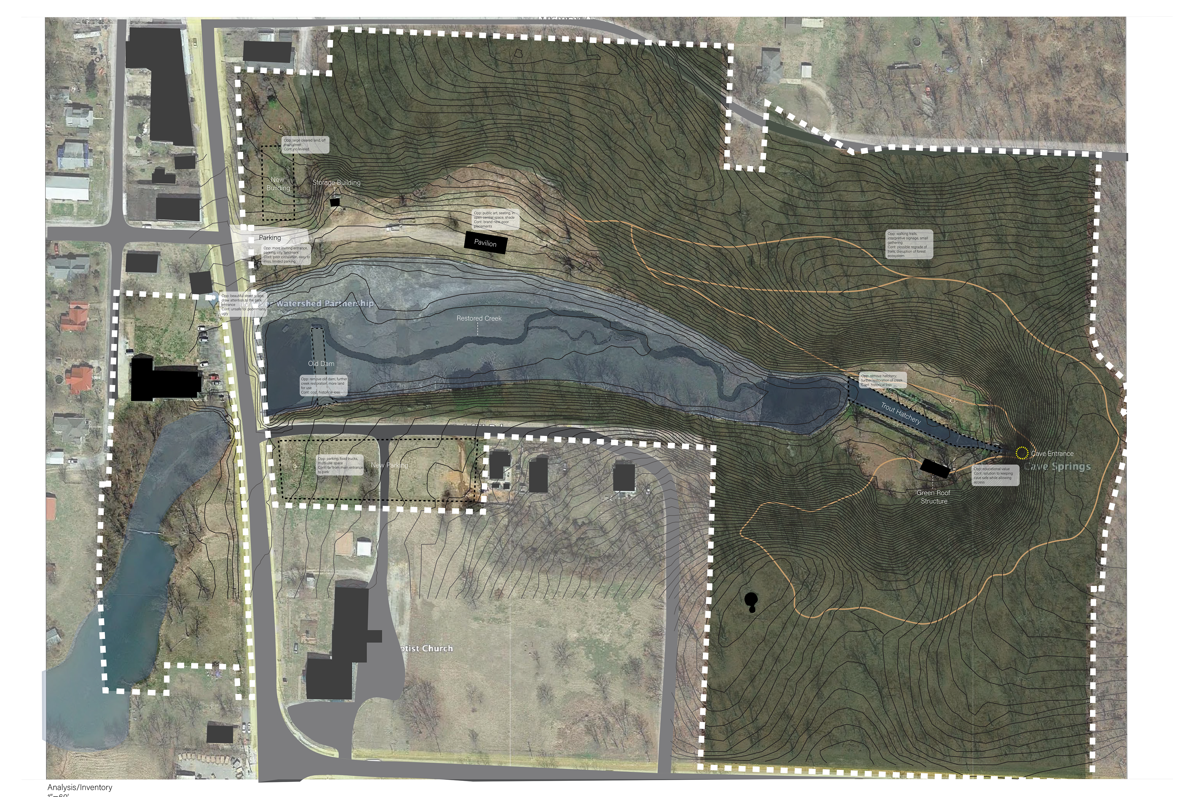
In this analysis diagram, the existing lake outline is shown in lighter blue, and the original creek path is shown in darker blue. The site as it exists today does not offer a lot to the community other than a place to fish and to walk. There are areas very close to main street and towards the back of the site that feel unsafe or exposed.


Cave Spring

Original Trout Hactery

In this collage, I wanted to capture the current character of the site while also acknowledging the town's historic past. The Cave Springs spring itself has been the lifeblood of the town for decades. There is no town without the spring. When it was dammed in the 1950s, the townspeople lost direct access to the water, thus creating a disconnected relationship.

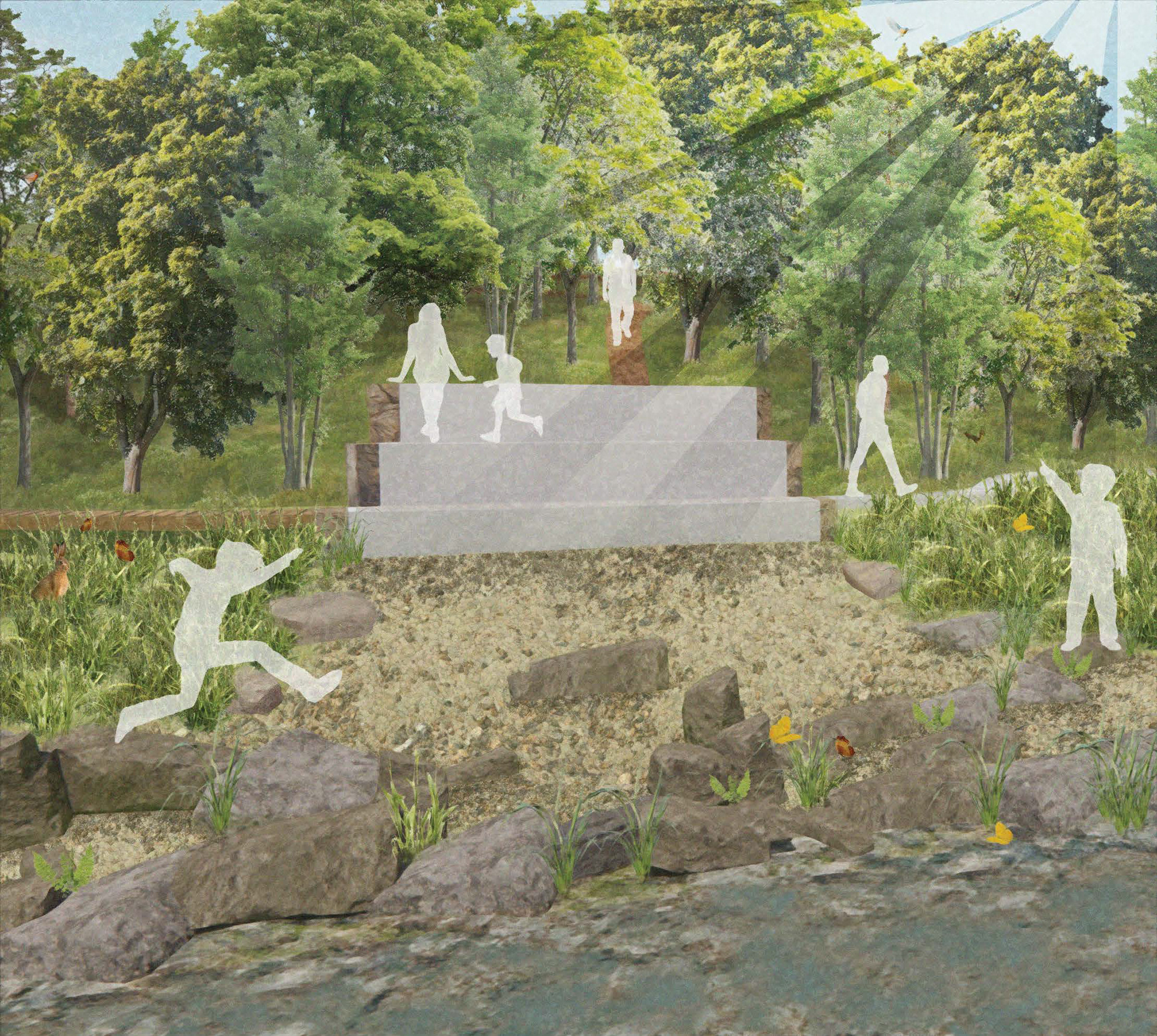
This collage gives perspective into what I wanted to include in my design. Innovative seating that works with the site's topography, elements of nature play, sensorial play, and a place for the community to gather close to downtown were all aspects I felt necessary to incorporate.

Large scale program diagramming

Slowly getting closer to a defined solution

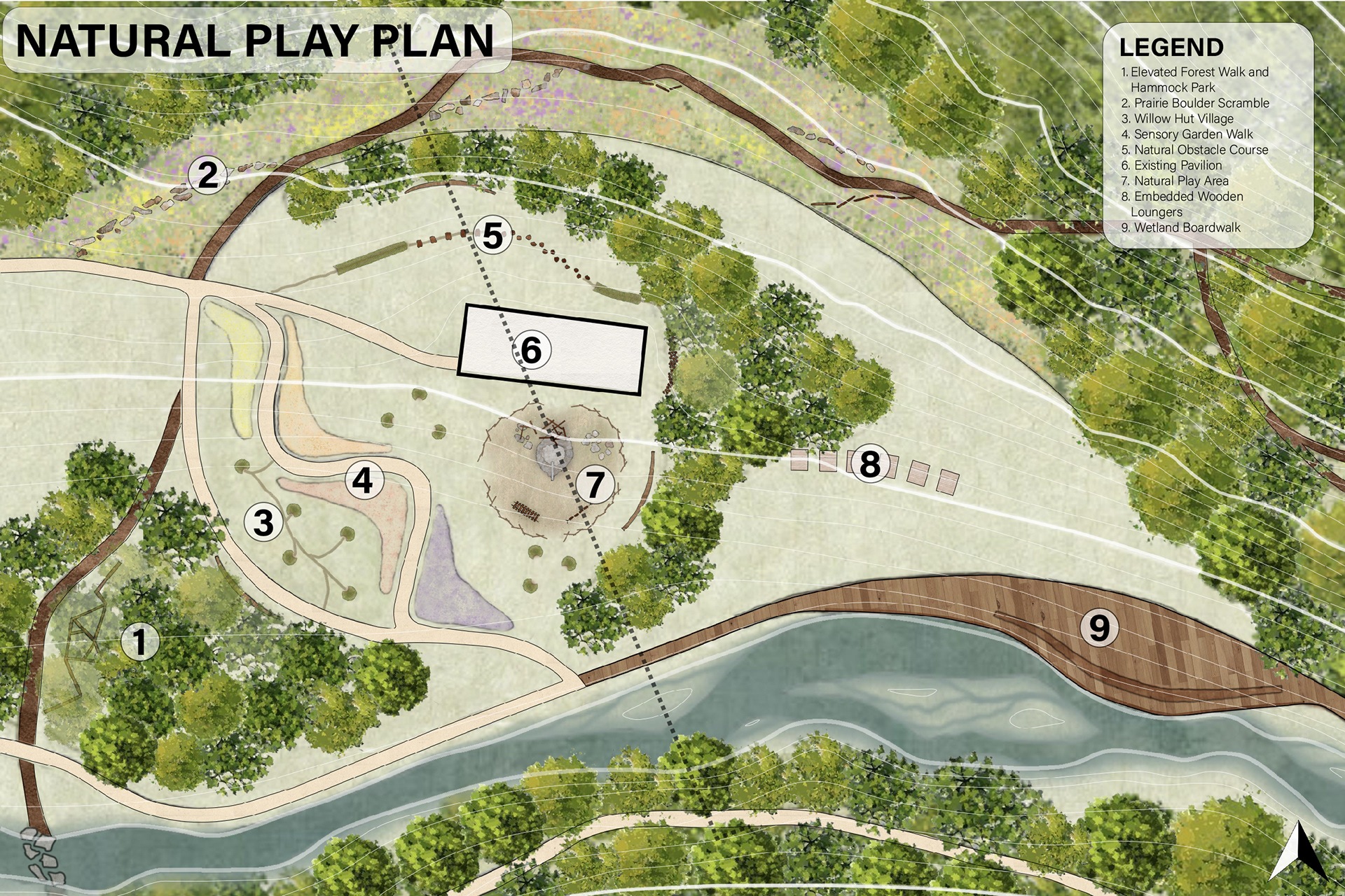
Decided on a circular programming for the natural play area

Ecological archetypes programming
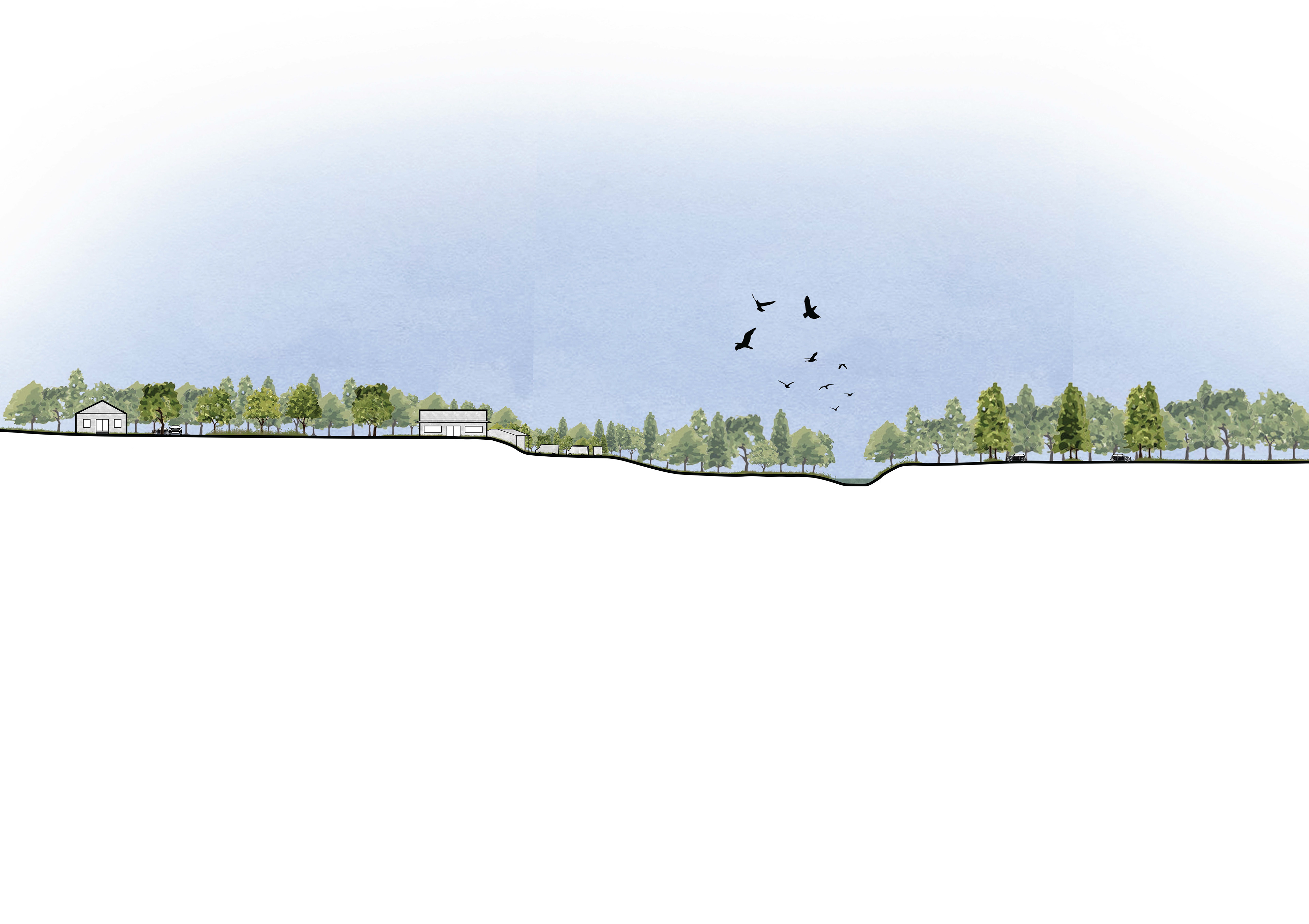
North-South section across the Main Street side of the park
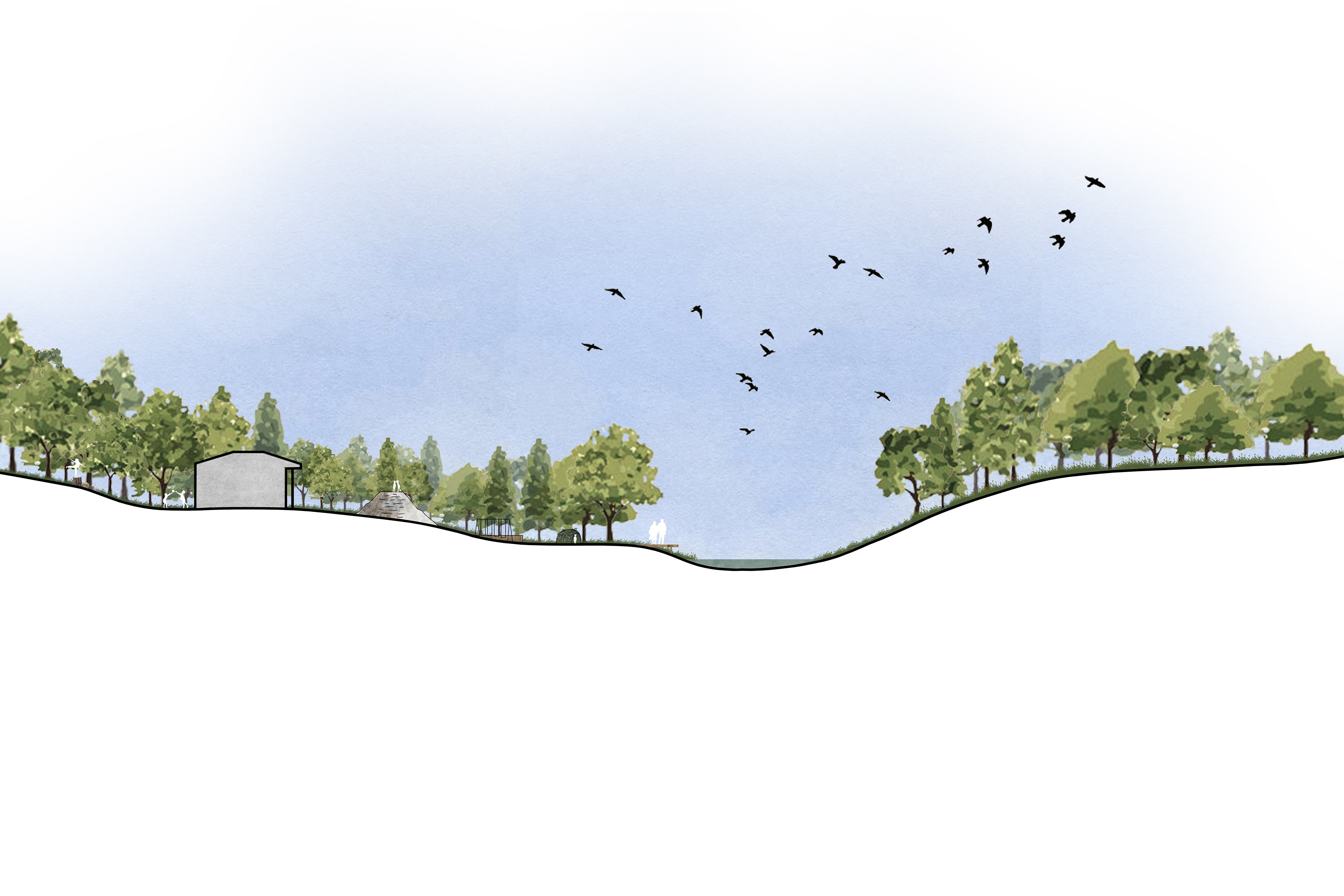
North-South section acorss natural play area

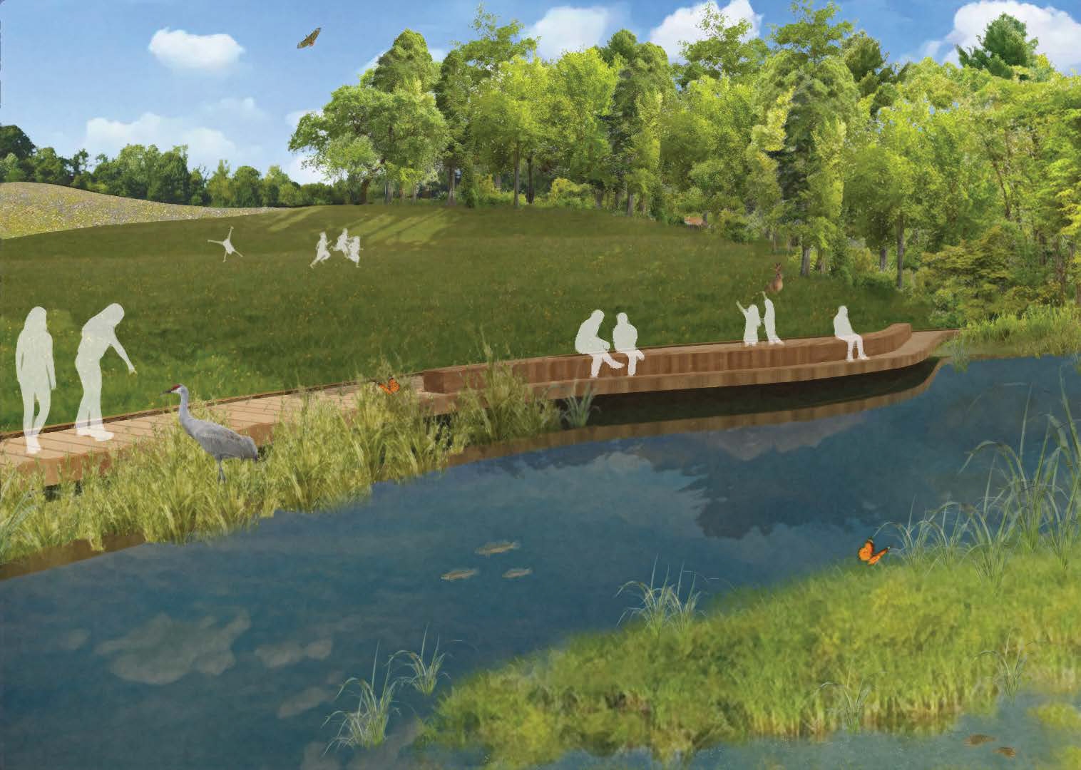
Wetland Boardwalk

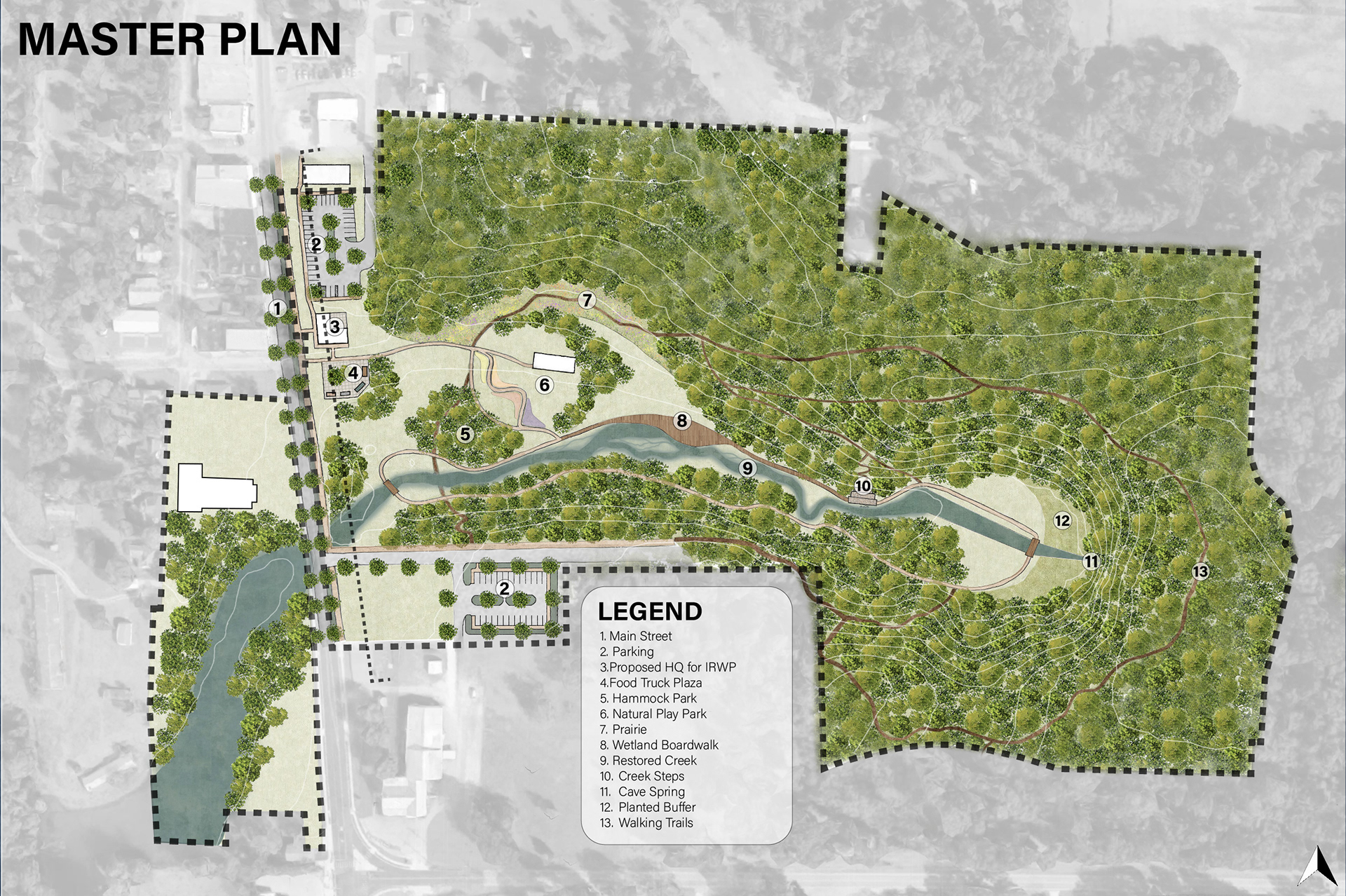
Natural Play Park